Organizer and operator:Mongolian National Chamber of Commerce and Industry, Nagoya BranchJAPAN MONGOLIA
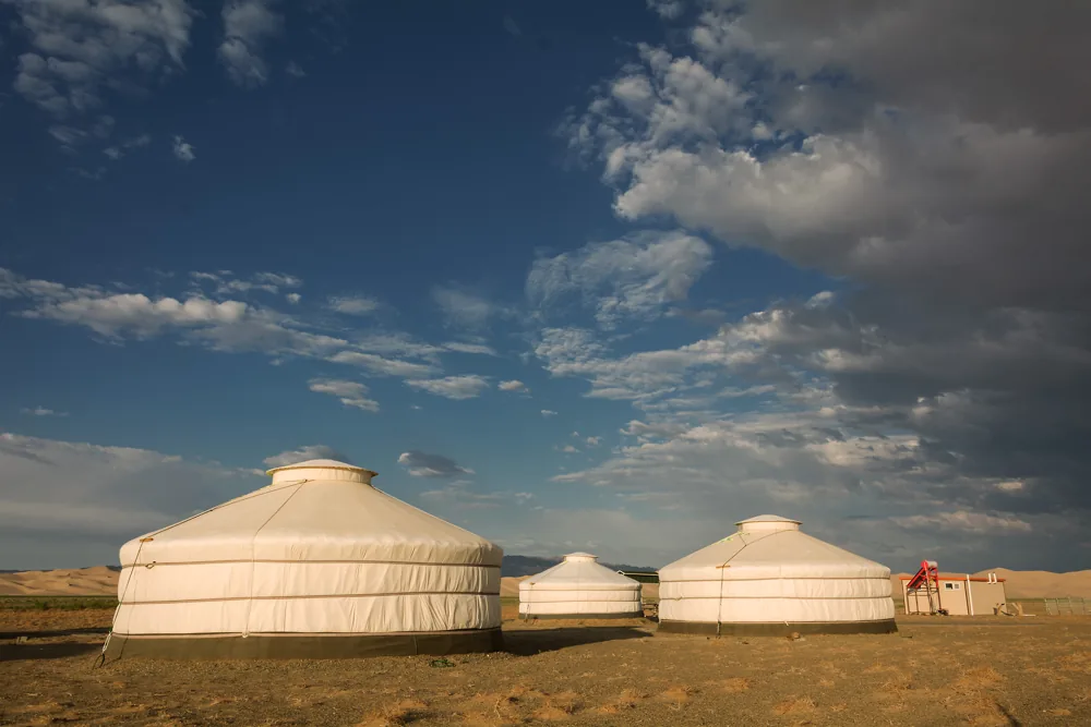
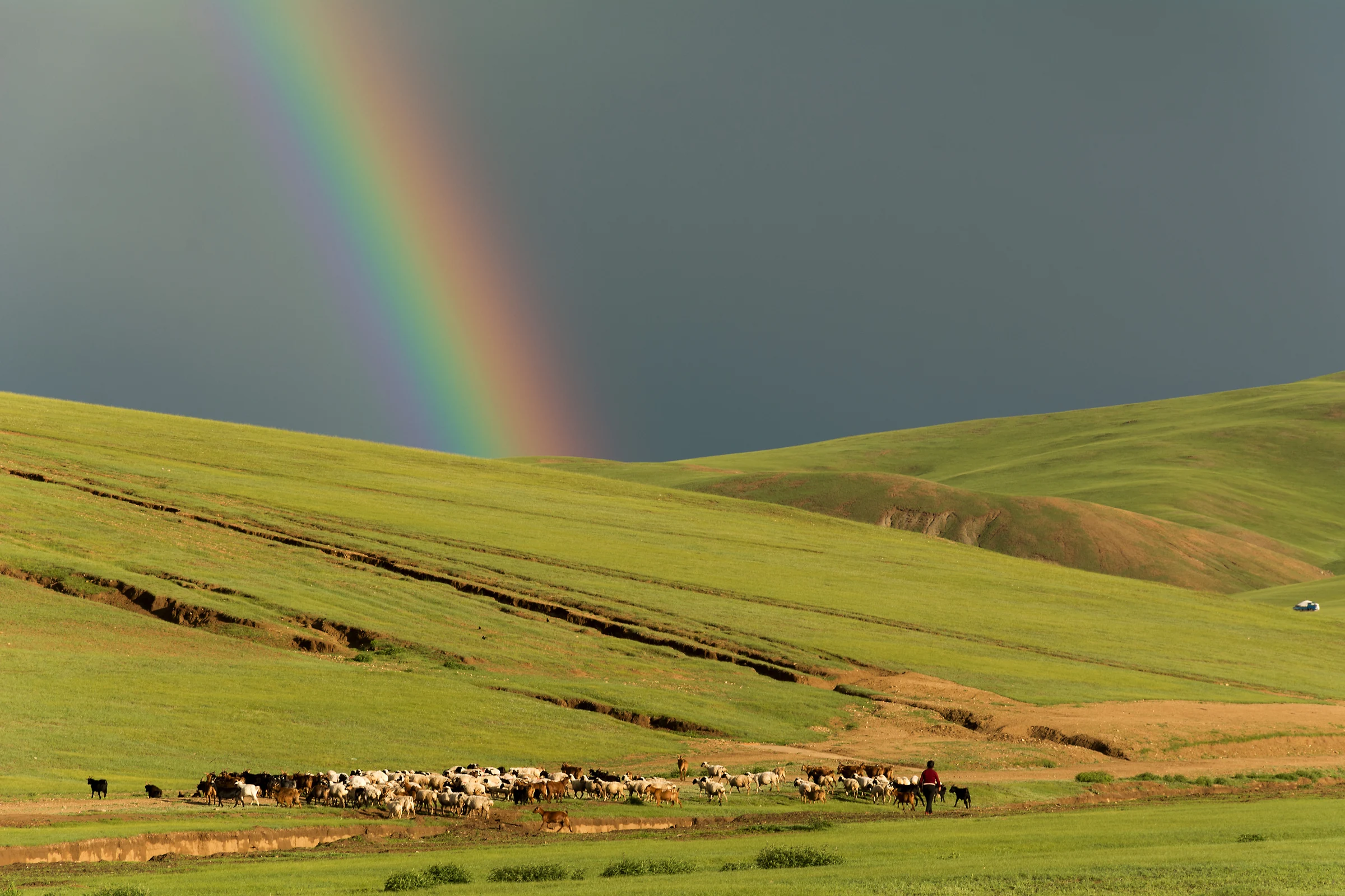
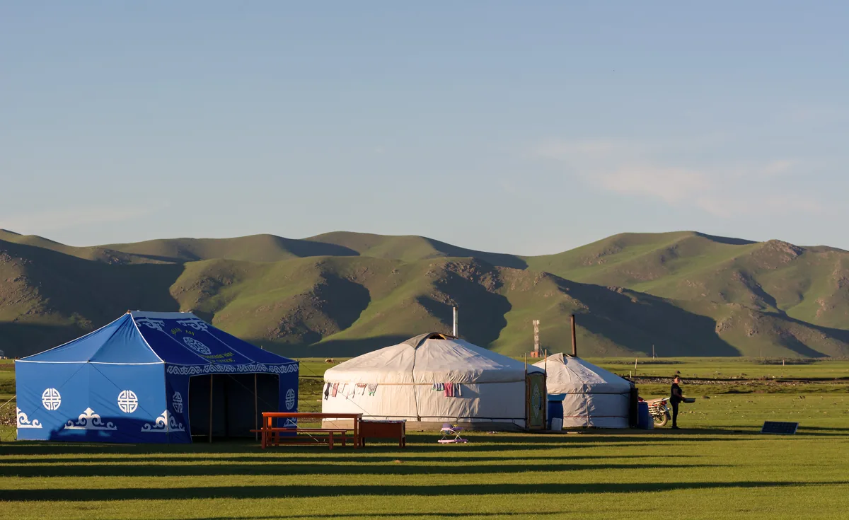
A green Mongolian grassland beneath a rainbow. This is a general landscape photo, not the site of the current fire.
Organizer and operatorMongolian National Chamber of Commerce and Industry, Nagoya Branch
MONGOLIA FIRE RELIEF

For Mongolia,
A circle of support.

For Mongolia, affected by wildfires.
We turn each person’s compassion into strength for recovery.

Donations accepted · Support by bank transfer
Donation start date
MONGOLIA, GREEN STEPPE & RAINBOW General landscape / Martin Vorel
SCROLL ↓
SUPPORT PROGRESS Payment received

Total donations received

Tally being prepared
The target amount will be announced once it is finalized.—
YOUR SUPPORT MATTERS

A small step,
For greater support.

Individuals, companies, and organizations are all welcome.
You can participate by bank transfer.

Proceed to the donation process
Planned transfers and reported amounts that have not been confirmed are not included in the total.Please wait for the organizers to verify the initial tally.
THE PLACE AFFECTED · Location of this fire

Before the fire, and after.
The same place, seen from space.

Actual observation images of the Numrug Protected Area are shown with the dates they were captured and their sources. These are reference materials based on satellite imagery, not photos of firefighting on the ground.

SATELLITE VIEW · Satellite imagery

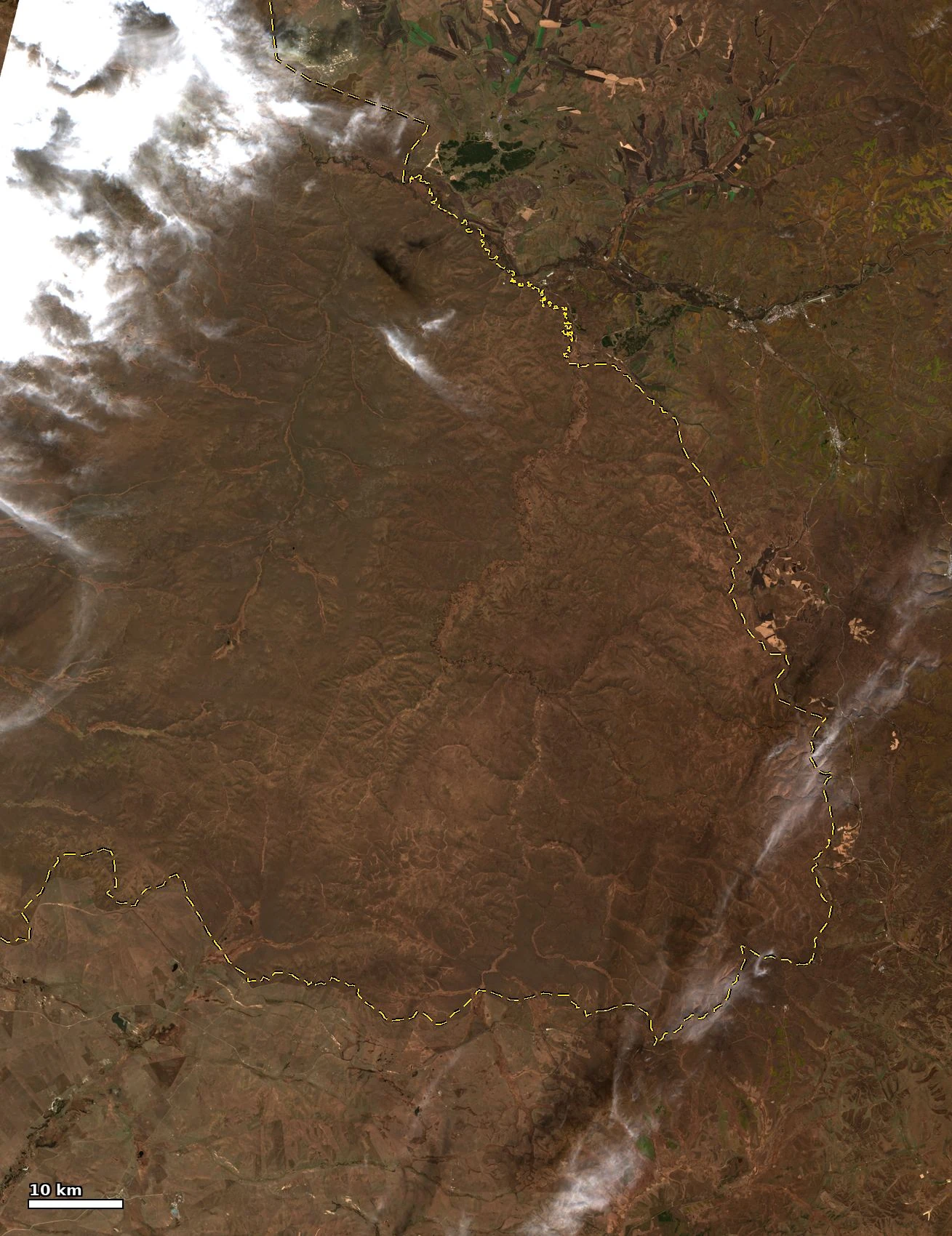
Numrug Protected Area before the fire

October 5, 2026, 11:04 (UTC+8)

True color
Numrug Protected Area before the fire. Satellite observation: October 5, 2026, 11:04 (UTC+8). True color. This is not a ground photograph.Tap to enlarge

A Sentinel-2C satellite image showing the grassland before the fire. It shows the same area as the later image, allowing you to compare changes in the location.

Contains modified Copernicus Sentinel data 2026/Sentinel-2 L2A・ESA L2A TCI(20m overview), via Element84 Earth Search. © OpenStreetMap contributors(ODbL). OSM attribution

Image created by: ringsaturn/CC BY 4.0. Changes: converted to WebP format only. No additions, color adjustments, or cropping.

Sources and explanation of observation data
SATELLITE VIEW · Satellite imagery

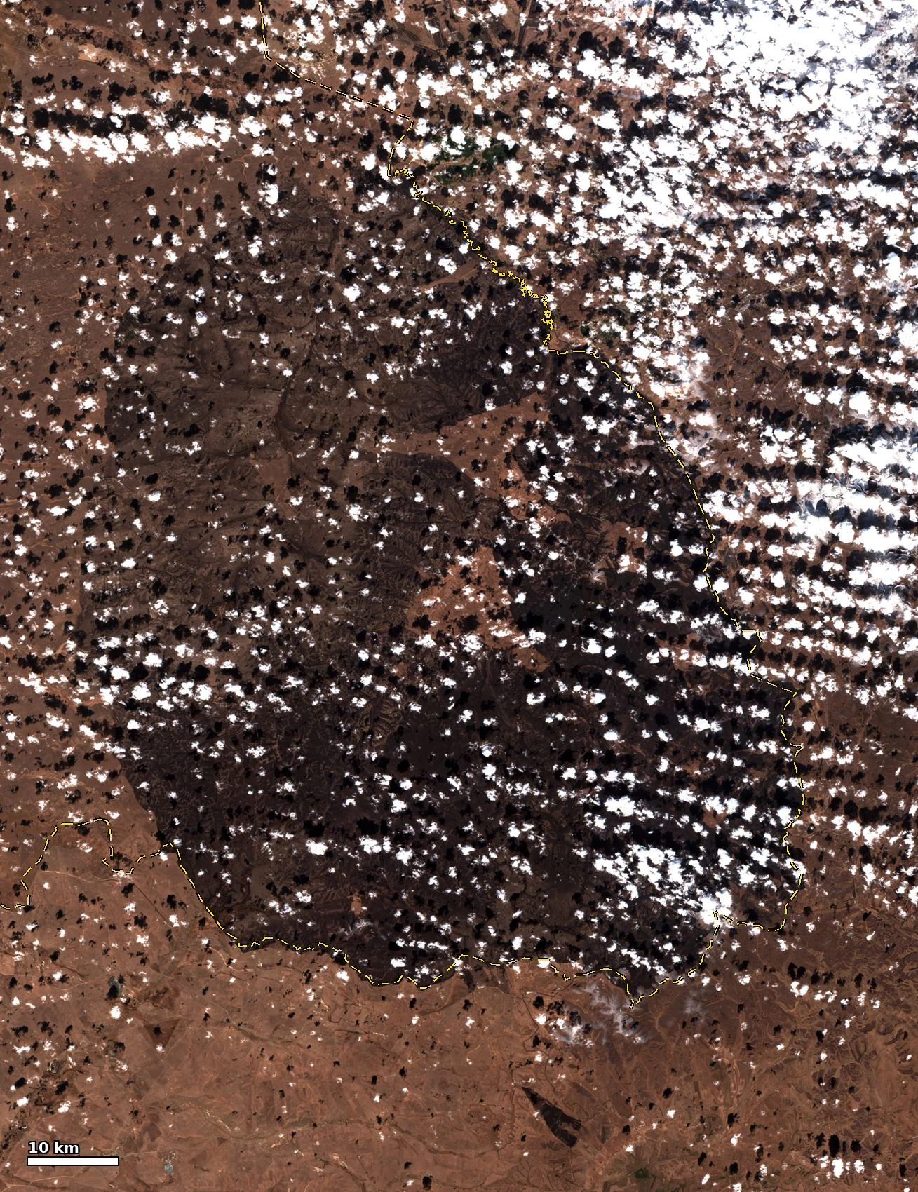
The same location seen from above after the fire

October 20, 2026, 10:57 (UTC+8)

True color
The same location seen from above after the fire. Satellite observation: October 20, 2026, 10:57 (UTC+8). True color. This is not a ground photograph.Tap to enlarge

A Sentinel-2B image showing the same area after the fire. Dark brown burned areas are visible. The white area to the east is cloud, and the black areas also include cloud shadows.

Contains modified Copernicus Sentinel data 2026/Sentinel-2 L2A・ESA L2A TCI(20m overview), via Element84 Earth Search. © OpenStreetMap contributors(ODbL). OSM attribution

Image created by: ringsaturn/CC BY 4.0. Changes: converted to WebP format only. No additions, color adjustments, or cropping.

Sources and explanation of observation data

These analytical materials were created using publicly available satellite data. They do not establish the cause, responsibility, or scale of damage based on images alone, and they are distinct from reports of this fundraiser’s activities.

FIRE SCENES & RESPONSE

The situation on the ground, through official photos.

We present five photographs of the October 2026 fire in Numrug Protected Area, published by the National Emergency Management Agency of Mongolia, together as one official album. The same post is not displayed repeatedly, and links to view each photograph individually are also provided.

These are distinguished from general landscape photos, and the official publication source is provided for each photo. Confirmed information from the organizers about the specific support and use of this fundraiser will be published.

Official photos and reports from external sources are displayed in the original wording provided by their sources.

ON THE GROUND · OFFICIAL ALBUM

Official photos of the fire scene and firefighting operations (5 photos)

Fire in the Numrug Protected Area · National Emergency Management Agency of Mongolia (NEMA)
Official post published on October 16, 2026

Official photos are displayed automatically; no click is required. When loading from Facebook, your IP address, browser information, and other data may be sent, and cookies or similar technologies from external services may be used. Registration information from the donation form is not sent.

Open photos one at a time

Individual photos open in the photo viewer on the official website. The embedded view displays the entire album.

If it cannot be displayed, please visit the official source above. The original photos have not been copied or altered. The date shown above is the publication date of the post, not the date the photos were taken.

Official photos and reports from external sources are displayed in the original wording provided by their sources.

ACTUAL RESPONSE · Firefighting operations on the ground

Actual footage from the official report showing firefighting personnel and vehicles.

The report dated October 16, 2026, published by the National Emergency Management Agency of Mongolia includes photographs of personnel and vehicles working amid smoke, and of burned terrain. These are not satellite images. The original photographs are not copied; the official page is displayed automatically as is.

The official report loads without a click. Your IP address, browser information, and other data may be sent to NEMA’s official website, and its cookies and similar technologies may be used. Information from the fundraiser registration form is not sent.

Scroll within the frame to view the photos. If they do not display, select “Open the official report in another window.”


Open the official report in a separate window

Source: National Emergency Management Agency of Mongolia (NEMA). The date is the report publication date. The individual dates the photos were taken and their photographers have not been confirmed. The photos may not be displayed depending on the publication status of the official page or the viewing environment.

01 ABOUT THE FUND
Together, take a step toward recovery.

Even from far away,
There is a way to help.

For fire relief in Mongolia,
We appreciate your support.

FOR MONGOLIA.
WITH CARE.

Fire relief in Mongolia

The Nagoya Branch of the Mongolian National Chamber of Commerce is collecting donations to support those affected by fires in Mongolia.

This fundraiser is organized and operated by Mongolian National Chamber of Commerce and Industry, Nagoya Branch. Donations by bank transfer are accepted, and supporter information is managed and incoming payments are verified. The designated recipient account is the account of that same branch.Please check the Bank Transfer Details section on this page for the official transfer destination.

How your donations will be used

The donations received will be used to support fire relief in Mongolia. We will announce the specific forms of support, recipient of the funds, and activity reports on this website once they are confirmed. We plan to deliver the donations kindly contributed by everyone through the Embassy of Mongolia in Japan to public institutions in Mongolia, such as local government authorities, for use in supporting the recovery and reconstruction of the affected areas.

Related news · NHK / 2026.10.23Major wildfire in a Mongolian protected areaWe will provide information about the relationship to the recipients of this fundraiser’s support after confirmation by the operator.
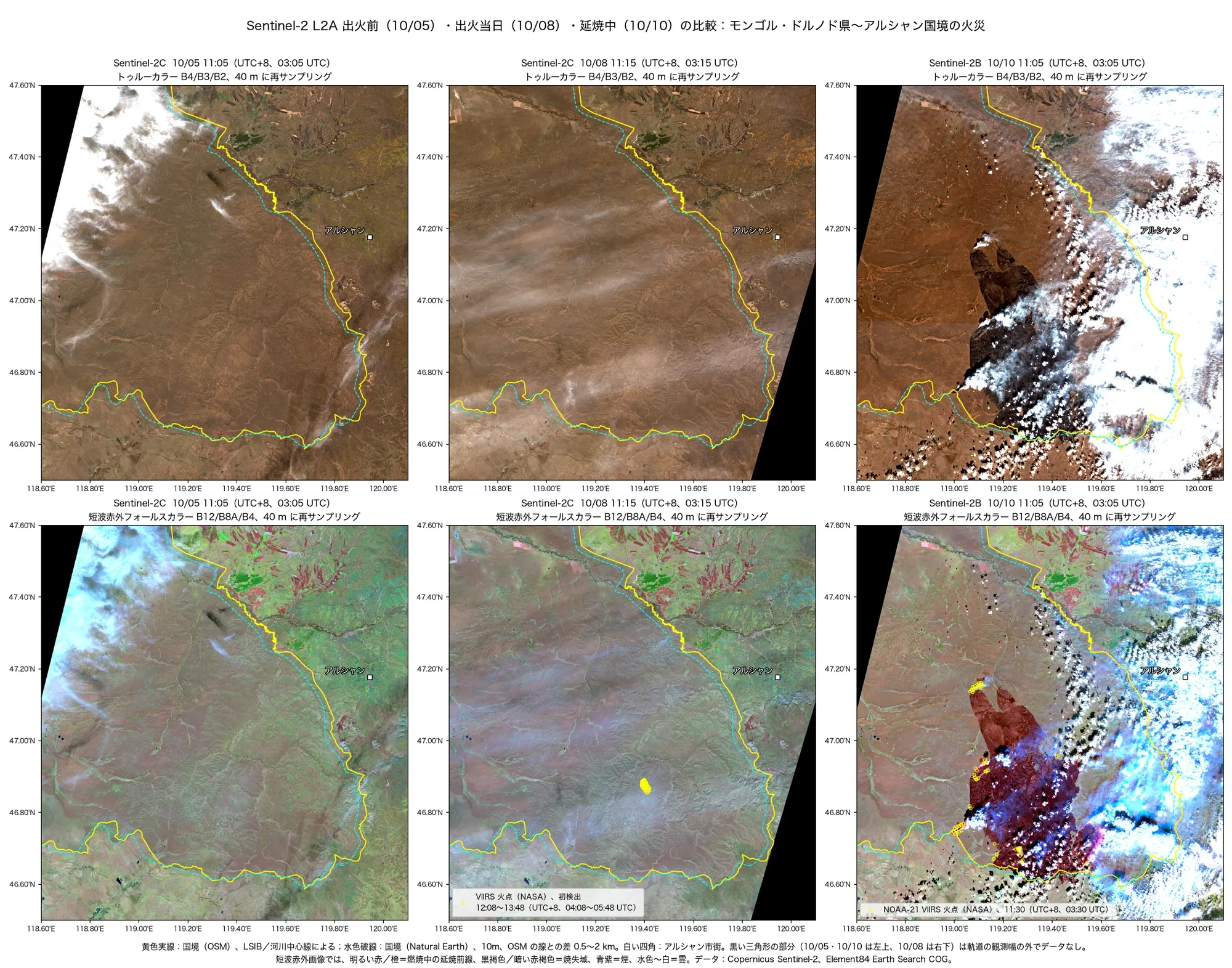
SATELLITE VIEW · Satellite imagery

Compare areas where the fire is still spreading using satellite imagery

October 5, 8, and 10, 2026

Top: true color / Bottom: shortwave infrared false color
Compare areas where the fire is still spreading using satellite imagery. Satellite observation: October 5, 8, and 10, 2026. Top: true color / Bottom: shortwave infrared false color. This is not a ground photograph.Tap to enlarge

These are Sentinel-2 observation images comparing conditions before the fire, immediately before ignition, and while it was spreading. The red and other colors in the lower row are enhanced representations using shortwave infrared; they are not the colors of flames as seen by the naked eye.

Contains modified Copernicus Sentinel data 2026/Sentinel-2 L2A, via Element84 Earth Search. © OpenStreetMap contributors(ODbL). Made with Natural Earth. OSM attribution

Image created by: ringsaturn/CC BY 4.0. Changes: converted to WebP format only. No additions, color adjustments, or cropping.

Sources and explanation of observation data
JAPAN & MONGOLIA · SUPPORT ACROSS BORDERS

Support from Mongolia that reached Japan in 2011.

Here we present support sent from Mongolia to Japan after the Great East Japan Earthquake, based on public records from that time.

Looking back at the record of support received across borders, we consider what can be done now to help affected areas recover.

Support from Mongolia at the time of the Great East Japan Earthquake
People and organizations that provided supportDetails of support
Government of Mongolia

Following the Great East Japan Earthquake, it donated US$1 million in relief funds.

The Ministry of Foreign Affairs’ Diplomatic Bluebook records that Japan received this donation.

National Emergency Management Agency of Mongolia

It dispatched an emergency relief team of 12 rescue personnel.

The National Archives records that the team operated in Miyagi Prefecture from March 17 to 19, 2011.

Government of Mongolia and Embassy of Mongolia in Japan

About 2,500 blankets and about 800 garments and pairs of items for cold-weather protection, including sweaters and socks, were delivered to Miyagi Prefecture. The Embassy of Mongolia in Japan arranged the shipment.

National civil servants

In response to the government’s appeal, all national civil servants decided to donate one day’s salary as relief funds.

Individuals, organizations, schools, and others

Fundraising activities involving individuals and organizations spread, and friendship associations, associations of former overseas students, JICA alumni associations, the Red Cross, schools, cultural groups, and others appealed for support for Japan and held charitable activities.

The records presented here document support provided in 2011. They are separate from the amount collected, remittances made, and funds needed for recovery in the current wildfire relief fundraiser. Amounts are shown in the currency and format used in the documents from that time and have not been converted using current exchange rates.

IMPACT · RECOVERY · THE ROAD AHEAD

The impact of the fire, and
Challenges that still need to be addressed.

To consider natural recovery and local safety, we have organized the issues into 3 categories.

What has been made public about this incident

NEMA reported that firefighting was completed on October 16, 2026. A MONTSAME report dated October 20 cited a preliminary estimate that about 79.8% of the Numrug Strictly Protected Area had burned and said that impacts on soil, water, flora and fauna, and the ecosystem over the long term would be assessed comprehensively. The fire being extinguished does not mean that the ecosystem has fully recovered.

Preliminary damage and publicly available investigation information
DAMAGE & RECOVERY COSTS

The amount of losses and the costs needed for recovery.

The public materials reviewed as of October 25, 2026, do not state amounts for the total losses, total firefighting costs, or the funding needed for recovery from this fire. The preliminary estimate of the affected area and confirmation of monetary amounts are treated as separate matters.

Value of environmental and property losses

Published amount unconfirmedUnder investigation and assessment

This is the stage for comprehensively investigating and assessing damage to soil, water, plants and animals, habitats, ecosystems, and property.
Costs incurred in firefighting

Published amount unconfirmedUnder investigation and assessment

Firefighting costs are also considered as part of the damage assessment. The public materials reviewed do not state the total cost.

Amount needed for recovery and natural restoration

Published amount unconfirmedUnder investigation and assessment

We will consider this after investigating natural recovery capacity and the necessary protection and restoration measures. We have not confirmed any publicly announced amount for the required budget.

How we will confirm the costs required

A MONTSAME report dated October 20, reporting on a study by people affiliated with the Ministry of Environment, says that satellite imagery, on-site measurements, surveys of plants and animals, and soil and water analyses will be combined to assess the damage, firefighting costs, natural recovery capacity, and necessary restoration measures. Specific costs need to be confirmed once the types of assistance, required materials, and scope have been established.

Published information on damage estimates and recovery planning (2026-10-20)

Unconfirmed amounts are not shown as 0 yen or as estimates. The target amount for this fundraiser and the total donations confirmed as received are separate figures from the overall losses caused by the fire and the amount needed for recovery. Statements of compensation, donations, or fines by companies and others are not treated as the required budget as-is. If verifiable cost estimates or publicly announced amounts become available, this information will be updated with the source, currency, announcement date, and whether the figure is preliminary or final.

01

Problems caused by wildfires

Even after the fire is extinguished, its effects on nature and people’s lives may not disappear right away.

Public information about this incident

Damage to grasslands and wildlife habitats

Preliminary reports indicate that a large area of the protected area has burned. The impact on vegetation, habitats for plants and animals, and the ecosystem as a whole cannot be determined from the area alone; field investigations are needed.

General risks

Health risks from smoke for residents and firefighting personnel

In general, fine particles in smoke may worsen respiratory and heart conditions. Care should be taken regarding smoke inhalation by firefighters and the health of children, older adults, pregnant people, and those with pre-existing conditions. The number of people affected by health problems in this incident has not been confirmed.

Areas of investigation and potential impacts

Impact on soil, water, and grazing environments

The current investigation will also assess impacts on soil, water, plants, and other areas. Damage to grasslands may affect fodder and grazing, but the specific extent of damage to livestock, homes, and livelihoods will be published after it has been confirmed.

Response to date and recovery challenges

The burden on the local area continues even after the fire is extinguished

NEMA reports that 109 people and 18 vehicles took part in firefighting this time. Personnel and equipment are also needed after the fire is extinguished for safety checks, damage assessment, and recovery, making it a challenge to determine what support is needed.

02

Problems that must be addressed

It is important to determine what is needed and organize support that prioritizes safety and the recovery of nature.

Required actions

Understand the full extent of the damage and local needs

We combine satellite imagery with on-site measurements, surveys of plants and animals, and soil and water analysis to assess the damage and set priorities. The starting point is to determine where support is needed, who needs it, and what kind of support is required.

Required actions

Protect the safety and health of residents and people working at the site

We will consider safety management by local agencies, checks for hazards such as remaining embers, measures to reduce smoke exposure, and arrangements to connect people with health advice or medical care when needed. Support needs to be adapted to conditions on the ground.

Approach to recovery

Restore in a way that suits the grassland ecosystem

Experts will determine which areas can recover naturally and where human intervention is needed. We will protect soil, water, native vegetation, and wildlife habitats, and avoid measures such as indiscriminate tree planting across the grassland.

Operational challenges for this fundraiser

Clarify who will receive support and how the funds will be used

The operating organization must determine the recipients, type, and allocation of support in light of local needs, and clearly report the amount of donations confirmed as received, transfers and expenditures, and activity results.

03

Challenges ahead

Support should not end after short-term assistance; recovery progress and measures to prevent recurrence need to be monitored continuously.

Long-term challenges

Assess long-term recovery

We will continue to monitor grassland regeneration, soil and water conditions, and the status of plant and animal habitats, and revise measures as needed. We cannot make a blanket promise about the recovery period or outcomes.

Prevention and preparedness challenges

Strengthen recurrence prevention and early detection

We will review precautions during dry and windy conditions, local rules on fires and access, reporting and early detection, and readiness of firefighting equipment and training. The cause and responsibility for this incident will be treated separately from the investigation findings.

Challenges in coordination

Coordinate with local agencies, residents, and experts

We respect the knowledge of public agencies, protected-area managers, local residents, and experts, and work to reduce duplicated support and gaps in assistance. We consider both nature’s recovery and local livelihoods when choosing practical responses.

Challenges in continuing to operate this fundraiser

Maintain ongoing support and accountability

It is important to establish an operating structure suited to the period for which support is needed and to continue publishing the total amount raised, how the funds are used, the results of activities, and any remaining challenges. Decisions about further support will be based on needs that have been confirmed.

About the use of donations and activity results

The information above summarizes the damage and necessary responses. It does not mean that donations will be used for all the measures listed here or that they have already been carried out. Information about the recipients of this fundraiser, its specific uses, and activity reports will be published once verified and confirmed by the organizers. Unconfirmed impacts on people, livestock, or homes, as well as the cause and responsibility, are not stated as facts.

02 HOW TO SUPPORT

Support us in 3 steps.

Match the registration with the bank transfer,
We will announce the confirmed donation amount.

01

Register donor information

Select whether you are an individual, company, or organization, then enter the donation amount and the name on the bank transfer, and other details.

02

Transfer to the designated account

Please check the displayed bank account information and make the transfer using the same account name as the one used for registration.

03

Payment confirmation and inclusion in the total

The organizers will verify incoming payments and add only confirmed amounts to the total donations.

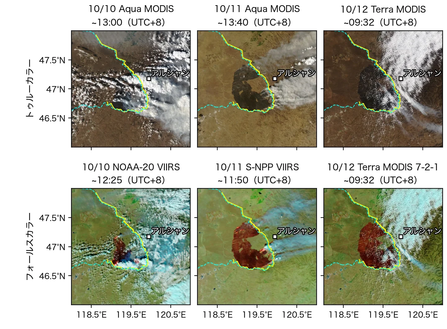
VIEW FROM ABOVE

The situation on the ground, from a different perspective.

These show the fire area and spread of smoke observed from above. True-color and false-color images are distinguished, and the observation date and data provider are given for each image.

SATELLITE VIEW · Satellite imagery

The burned area and spread of smoke, seen from above

October 10–12, 2026

Top: true color / Bottom: false color
The burned area and spread of smoke, seen from above. Satellite observation: October 10–12, 2026. Top: true color / Bottom: false color. This is not a ground photograph.Tap to enlarge

These are daily observation images from NASA's MODIS・VIIRS. In the false-color imagery, dark reddish-brown indicates burned areas, bright red and orange indicate active fires, and light blue indicates smoke. These are not photographs of firefighting operations on the ground.

NASA GIBS/Worldview daily MODIS–VIIRS imagery(250–375m). © OpenStreetMap contributors(ODbL). Made with Natural Earth. OSM attribution

Image created by: ringsaturn/CC BY 4.0. Changes: converted to WebP format only. No additions, color adjustments, or cropping.

Sources and explanation of observation data
05 TRANSPARENCY & UPDATES

Beyond support,
We will let you know.

Information on how donations are used and the status of activities
We will share information as it is confirmed.

Information

Donations by bank transfer are being accepted

After registering your donor information, please transfer the funds to the designated account. Transfers will be included in the publicly displayed total donations as they are confirmed.

We will publish an activity report as soon as the information is ready.
TOGETHER, FOR MONGOLIA

Together, let’s build a circle of support.

Proceed to the donation process